
We left Naukati Bay early in the morning and on the journey to the ferry noticed that our leisure batteries were not charging. With a freezer packed with shrimp, halibut, moose, ground pork, rhubarb and fruit (a big thanks to Jerry, Hooter and Leslei) we were keen to get the problem resolved as quickly as possible.
And here is a great example of the genorosity of Alaskans.
A member of staff on the ferry had seen our Land Rover and was keen, as a fellow Land Rover owner, to find us and have a chat. On hearing that we had a battery charging problem he contacted a friend of his, called Mike, who lived in Ketchikan and who was also a Land Rover owner.
Arrangements were made for us to meet with Mike when we got off the ferry and Mike gave us directions to his house. By the time we had reached Mike’s house Chris, Mike’s wife, had freshly baked scones waiting for us. Mike and Chris offered us a bed for the night and even took us out for a meal, refusing to let us pay as we were “on their territory”. A very big thanks goes to you both for your kindness and hospitality.

The leisure battery was connected overnight to Mike’s battery charger and by the morning was nearly fully charged, allowing us to put the fridge/freezer back into operation. This would keep all food frozen while we spent the next 28 hours on the Alaska Marine ferry travelling up the coast from Ketchikan to Skagway.
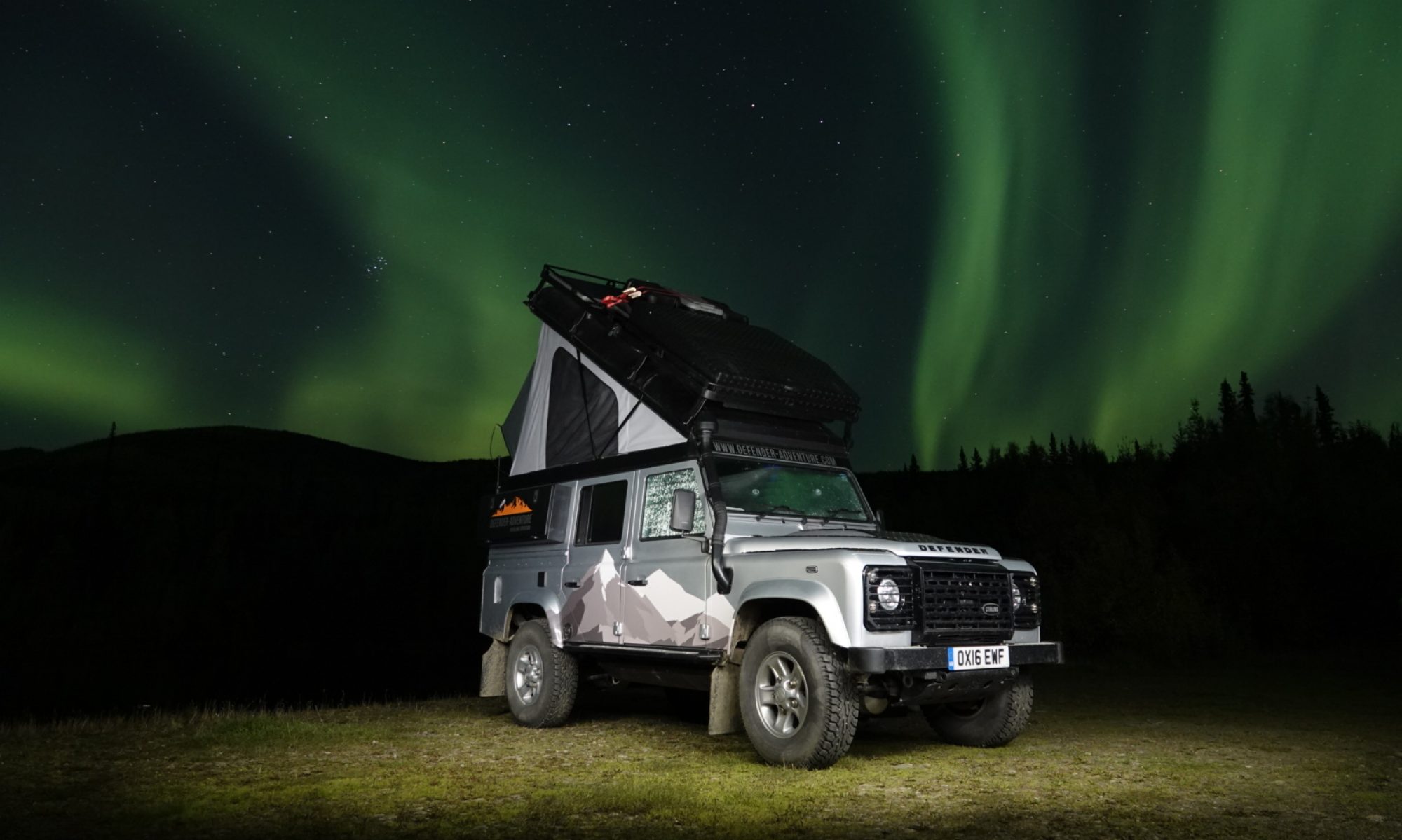
Taking Chrissie up the Inside Passage was more enjoyable than I ever thought it would be. At times it seemed very tight with little room to manoeuvre but, with a lot of patience and taking it very slowly, the tricky operation was completed without even touching the sides. We both enjoyed it very much.


Chrissie enjoying the Inside Passage
The sea remained flat and the weather clear for the entirety of the journey allowing some wonderful views along the way.
We were still awake as the ship docked in the dark at Petersburg but we did miss the arrival at Juneau at 4.30 a.m. as a result of being fast asleep.

Petersburg at night – honest!
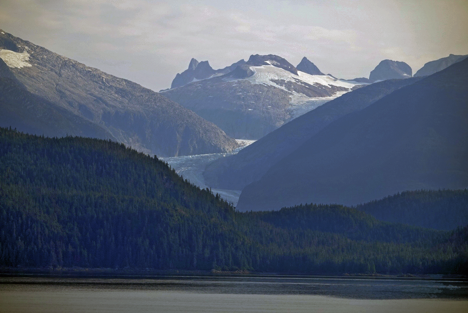
We woke as the ferry was departing Juneau and looking out of our cabin window saw our first views of glaciers in the early morning light.
We arrived in Skagway mid-afternoon and was disappointed to see the small town completely dwarfed by three large cruise ships

Other than stopping briefly for some groceries we departed Skagway and left the crowds of people behind us as quickly as we could.
Only 14 miles after leaving the ferry and we were at the Canadian Border. A friendly border guard let us in to British Columbia and we started to look for a place to camp for the night. We passed a black bear at the side of the road just minutes after the border crossing and a few minutes after that found an ideal place to stay for the night by the side of a small lake.

A couple of other travellers had the same idea as us and we spent an hour or two chatting with them before having our grilled shrimp dinner. Dinner was delicious, we went to bed early, woke early and set off after breakfast with the sun shining in a clear blue sky.
With the battery charging problem still not resolved we made the decision to amend our planned route slightly and to travel to Whitehorse where we felt there would be sufficient resources and services to get the matter sorted.
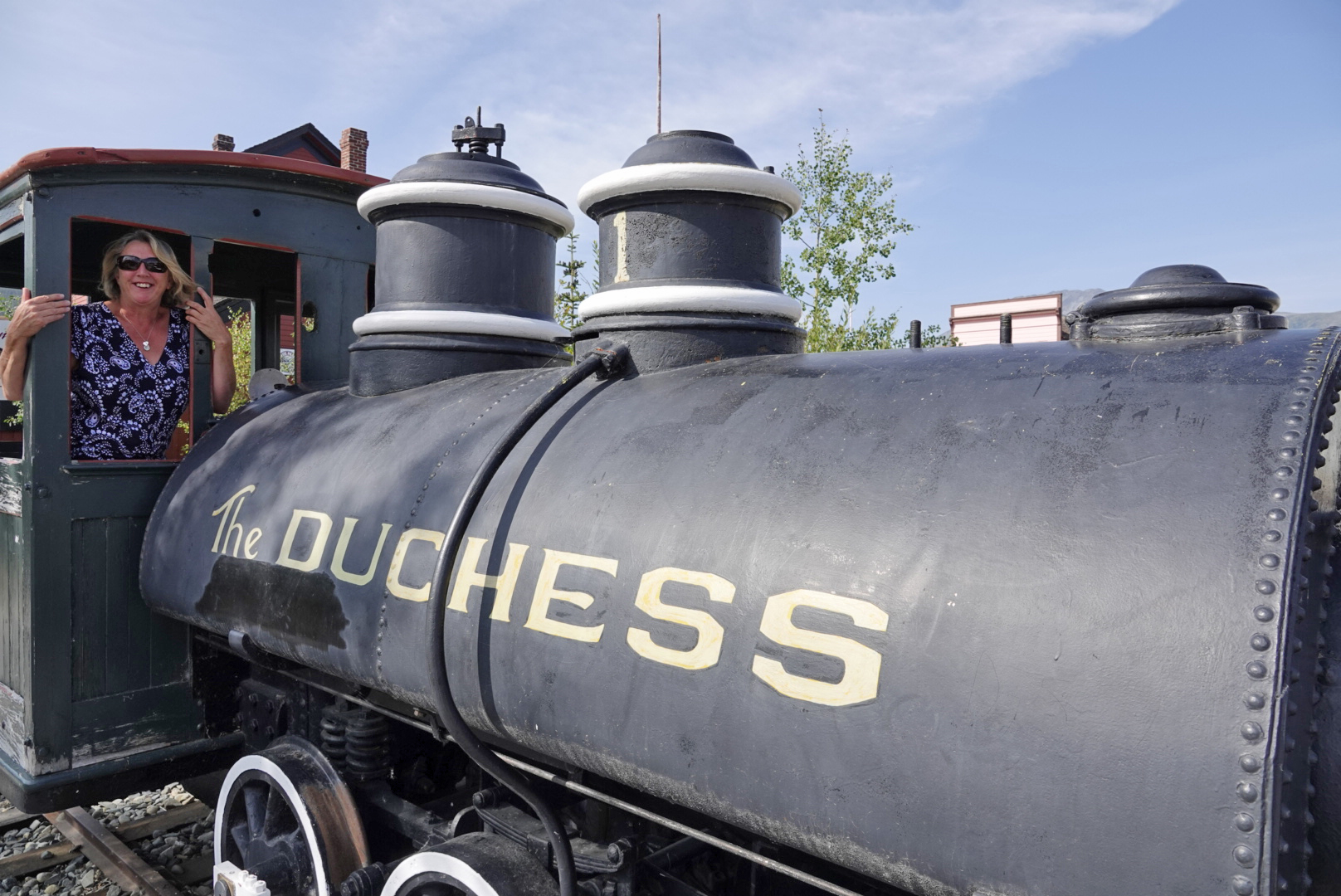
The only small town that we came to on our way north to Whitehorse was Carcross and it was here that Chrissie found a train with her name on it!
A couple of miles north of Carcross and we passed the colourful Spirit Lake

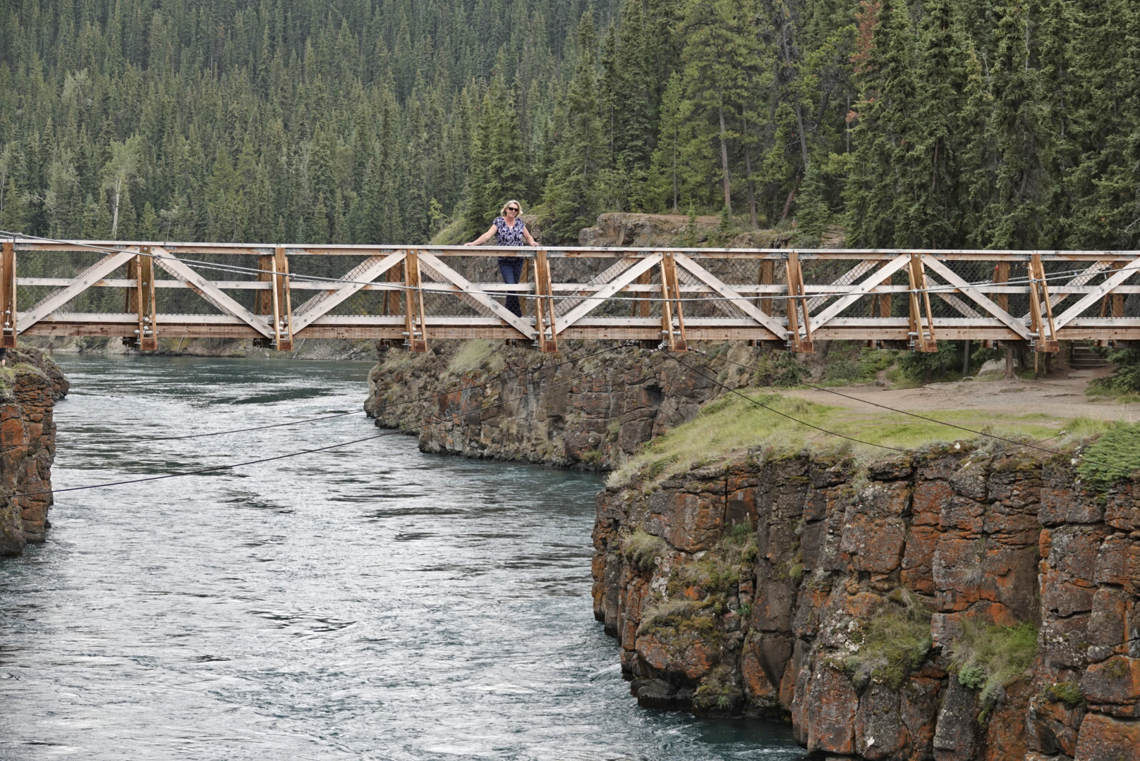
And just prior to entering Whitehorse we visited Miles Canyon and the impressive Yukon River

We reached Whitehorse early afternoon and on the outskirts of the town came across a car repair garage whose owner, Neil Runion, offered to look at our electrical problem. Using his test equipment he identified a 60A fuse had failed and fortunately we had brought a spare fuse with us. Paul fitted the replacement fuse and we were driving out of Whitehorse by mid-afternoon.
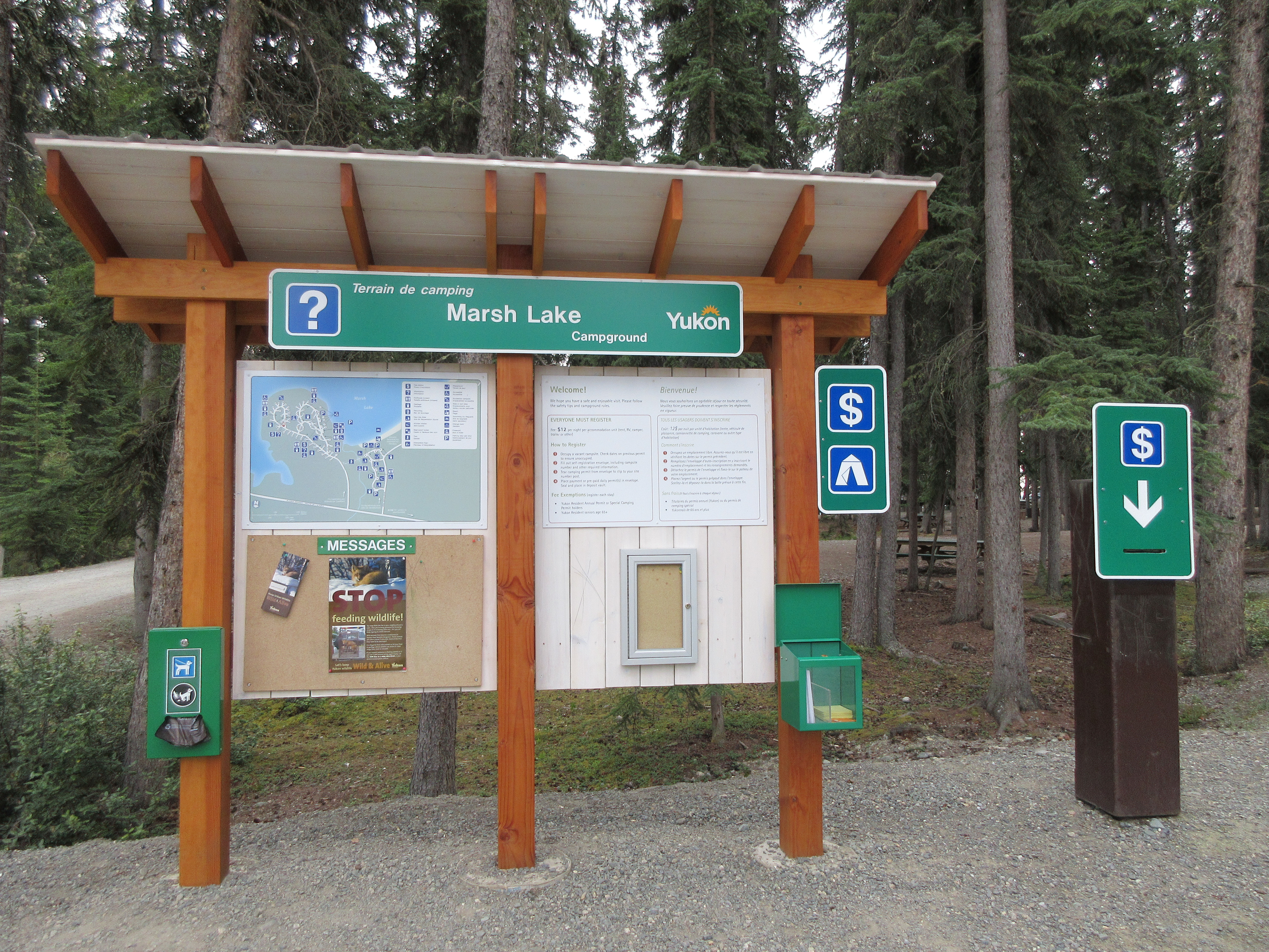
We stayed that night at Marsh Lake Campground, a Yukon Government run campground. This was our first experience of this type of campground and we were pleasantly surprised to find that for 12 Canadian Dollars (£7.50) you could have a campsite with large table, fire pit and free firewood. Bear proof bins and pit toilets are also provided. Yukon Government campgrounds operate under a honesty self-registration and payment system.

After another early night and early morning start we set off the following day and drove back onto our planned route. This route would take us along the Alaska Highway to Johnsons Crossing from where we would travel northwards on the South Canol Road to Ross River.
In an attempt to support the war effort construction of the Canol Road commenced in 1942 to allow installation of a 4″ oil pipeline that would route oil from its source along the Mackenzie river in the Northwest Territory to a refinery in Whitehorse. The approved budget for the road and pipeline was 24 million US dollars. By 1944 the oil line was in operation, however, by March 1945 the refinery was closed and the oil line was shut down. A total of 13 months of operation at a cost of 134 million US dollars.
We had chosen this route as we had read that it was much less travelled yet was very scenic. We also read that the road was only open when weather conditions allowed.
At Johnsons Crossing, the start of the South Canol Road, we came across some of the military vehicles that had been in use at the time of the road construction.
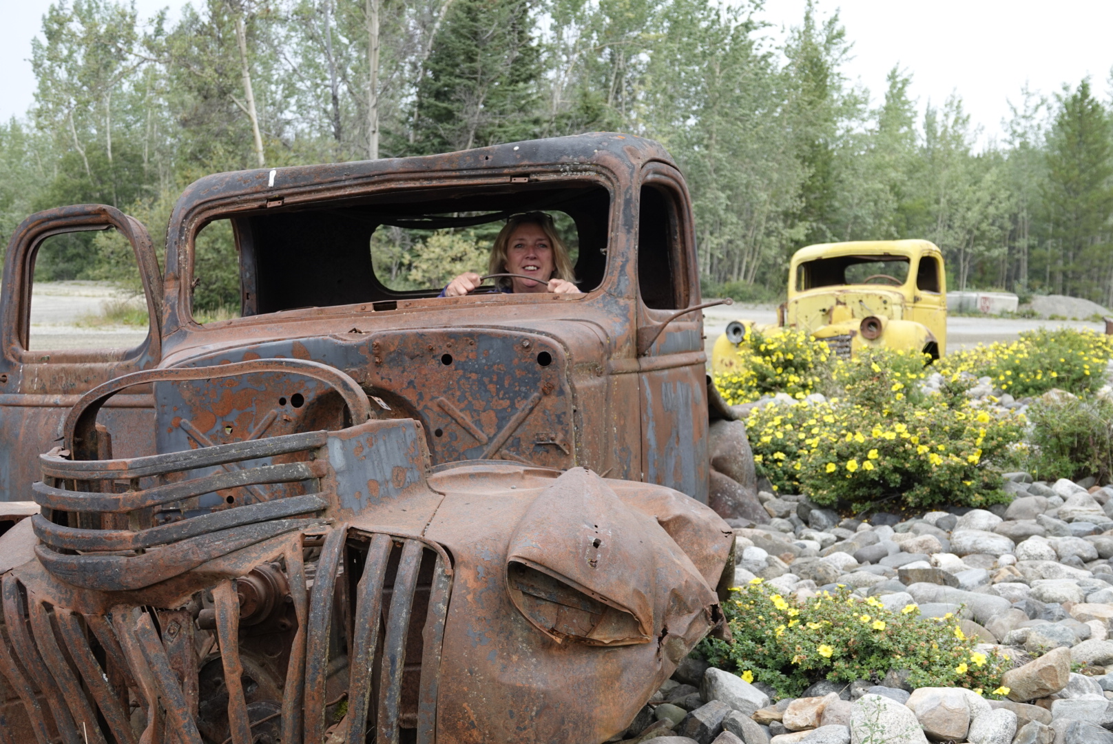
Look at that old wreck! 

Surely she couldn’t leave Stirling
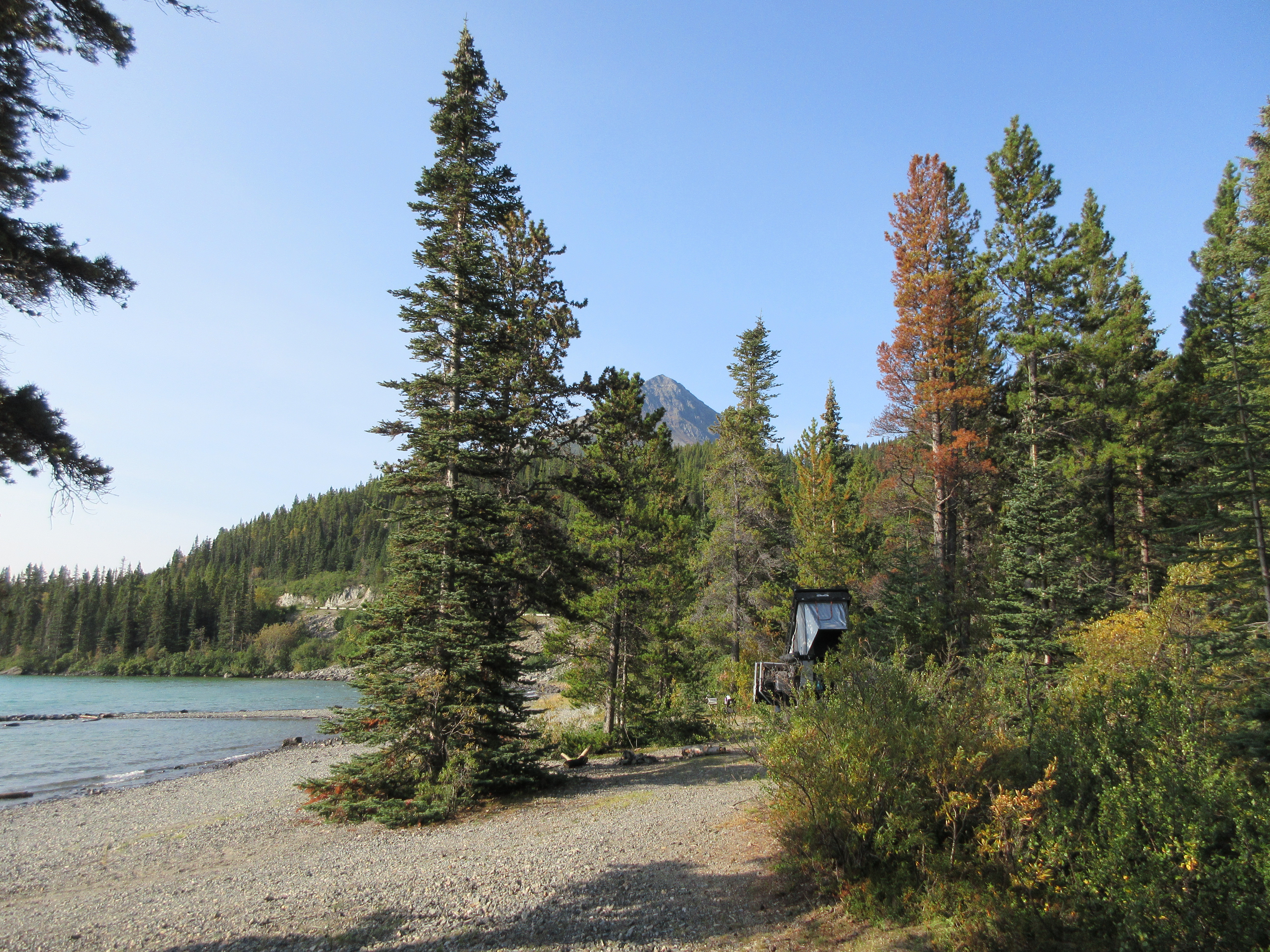
We travelled just over half the length of the South Canol Road on the first day and stopped overnight at another Yukon Government Campground at Quiet Lake (North). We had read that this was a good area for sighting bears and moose but it seemed no-one had told the bears or the mooses.

We had been disappointed in the lack of scenery and wildlife that we had been hoping for. A partridge in a tree (no, not a pear tree) was the only wildlife we passed that first day.

The following day, however, things improved. Not so much on the wildlife front but definitely in the scenery department


Arriving at the end of the South Canol Road we crossed the Campbell Highway to make a short trip to Ross River. We didn’t stay long.

You most certainly are! 
Free ferry crossing
If we had wished to explore the North Canol Road we could have taken the free ferry across the Pelly River but as we wanted to continue our journey towards Alaska we headed back towards the Campbell Highway and our overnight stop at Lapie Canyon. (another Yukon Government Campground).
The next morning after a short drive we came to the small town of Faro (population 344) and it was here that we decided to have a catch up with laundry and showers.

Faro is a town in the central Yukon and was the home of the Faro Mine, the largest open pit lead–zinc mine in the world.

Surely she can’t leave Stirling
The town’s Visitor Centre was a wonderfully kept building, with neat manicured gardens, and was packed with information and displays. We were welcomed with coffee and cake. We both had a lovely hot shower at the RV park (take as long as you like we were told) and then washed and dried all our dirty clothes in the laundrette all for the sum of 10 Canadian dollars (£6.00).
The weather changed while we were in Faro and a decision was taken not to camp in the rain. We spent the rest of the day exploring Faro and the surrounding area but with the rain getting worse we quickly found a small studio hotel and bedded down for the night.
Leaving Faro the next morning (the rain had stopped but skies were still heavy and grey) we were headed for Dawson City, a journey which would take us a couple of days. We reached the end of the Campbell Highway at Carmacks (brief stop in Carmacks for food and fuel) and then turned north onto the Klondike Highway.
An overnight stop at another Yukon Government campground that night at Ethel Lake (some 16 miles down a rough gravel track) and we were back on the Klondike Highway the following morning with the expectation of being in Dawson City around midday.
Curiosity, however, got the better of us and we decided to explore the Silver Trail Road that led to Mayo and then the remote mining town of Keno City.


We stopped briefly in Mayo to look at the overgrown Pioneer Cemetery


Continuing north along the Silver Trail Road towards Keno City our elevation was increasing all the time and we were soon looking down into wooded valleys. It was here that we noticed large areas of forest that had been burnt and in some places we could still see smoke rising from between the trees.
We turned a corner and there right at the side of the road was a helicopter re-fuelling.

We sat and watched as the helicopter took off and headed for a nearby lake. It had one of those dangly things with a large orange bag at the end which it could fill with water and then accurately deposit the water where required.
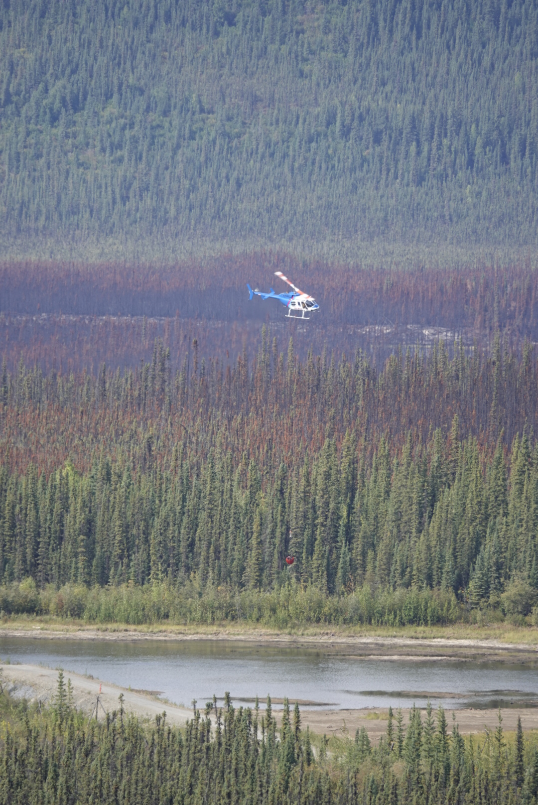
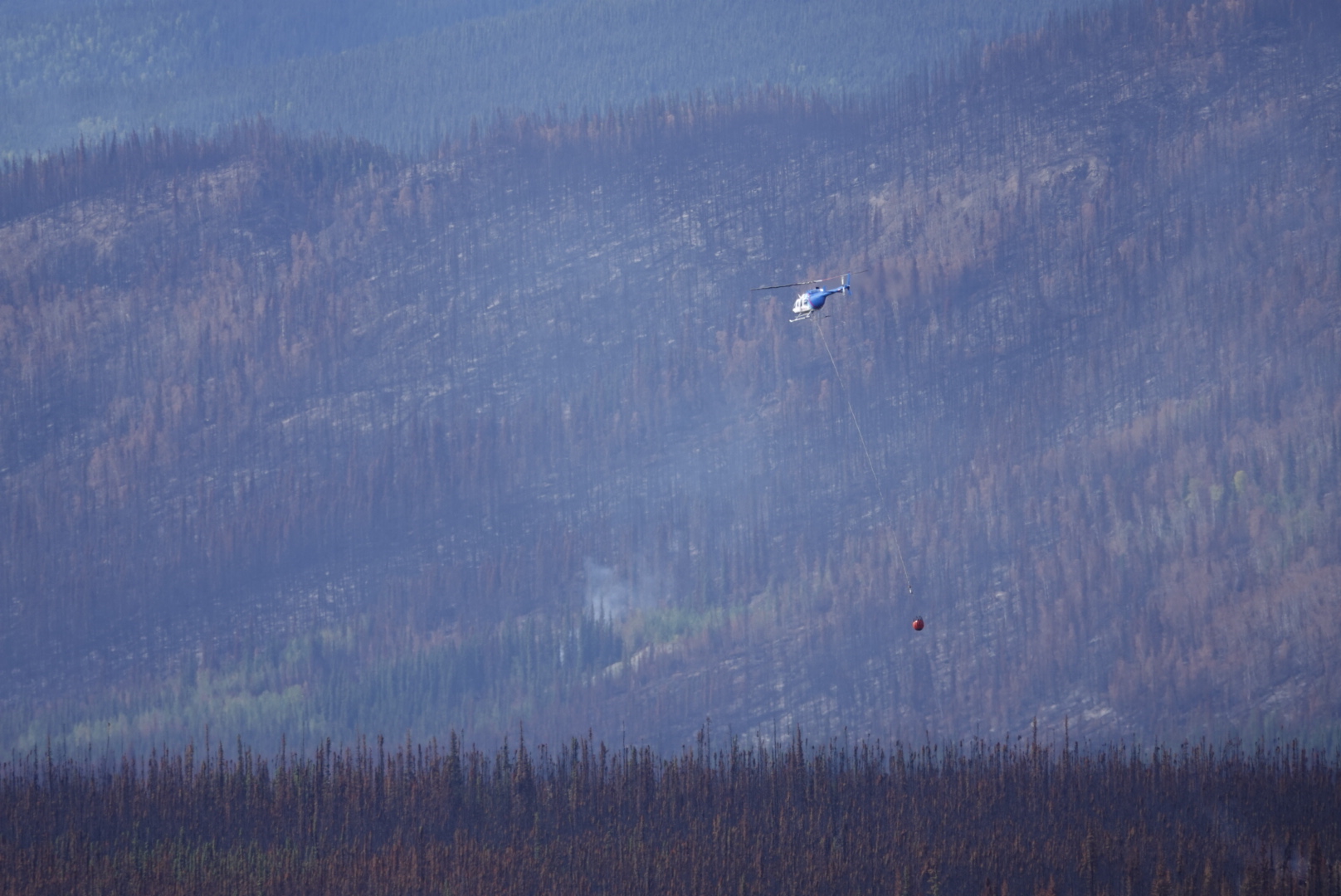
We later learnt that the main fire had been put out over a month ago and they were still dealing with the aftermath of mainly ground fires where the fire had got deep into the moss.
We passed a Yukon Government Campground on the way to Keno City and initially intended to return to this at the end of the day, however, when we arrived in Keno we found they had a community campground. We parked there and set off to explore the small mining town and its mining museum.


It’s called Keno City but today’s official population is 20, well down from its heyday during the Klondike gold rush. Although we did find a couple of extras that may not have been included in the population count


Back at the campground Paul took the opportunity to give Stirling a bit of TLC

Given that we were only a couple of hundred miles from the Arctic Circle, and at an elevation of over 5000 feet, it shouldn’t have been too much of a surprise that it was cold at night, however, this was not what we were expecting in mid-August. It was the first night we slept with the diesel heater running.
We woke to a bitter cold morning with a low sun in a blue sky. Paul had the bright idea of getting out of the shade of the trees and heading higher to a place called Signpost, which was at the summit of the nearest mountain, where we could enjoy breakfast with a view and hopefully be in the sun.

A signpost to signpost!
We left Keno City and followed a rough stoney track uphill for around, well 11km, as the sign says.
The views on the way up and at the top were wonderul

Now we know why its called Signpost 


As beautiful as it was it was even colder in the sun at the summit than in the shade at the campground so we dropped back down the hill a short distance to try and get out of the wind and find somewhere we could have breakfast.


We found a lovely spot for breakfast near the near the entrance of an old abandoned mine but if anything it seemed even colder. Puddles near the mine were frozen and it took an age to heat water for our morning coffee. What was going on – it was mid-August for heavens sakes!
After lukewarm coffee and a cold fried egg sandwich (mmm..) we headed back down with the heater turned to high. Dawson City here we come.
Just as a postscript to this blog I would like to thank Pam and Cole for their kind gift of homemade summer sausage (which we watched them make and smoke when we stayed with them in Naukati).
I am, however, struggling to get Chrissie to allow me to cut it.


HEY WATCH OUT FOR THOSE BEARS THEY ARE HUNGERY THIS TIME OF THE YEAR !!
HOPE ALL IS GOING GOOD FOR YOU GUYS. LOOKS LIKE A NICE TRIP FORSURE.
LIFE IS GOOD ON THE ISLAND–TAKE CARE HOOTER
LikeLike
Hey Hooter
Good to hear from you
We haven’t seen a bear at all in Alaska since we left the Island
In Fairbanks right now, just got back from driving the Dalton Highway up as far as Gilbraith Lake – road in terrible condition after that.
Stirling, our Land Rover has now started to keep his own journal. Check out
Take care both of you
Love P & C x
LikeLike
Glad you resolved the battery charging issue.
LikeLike